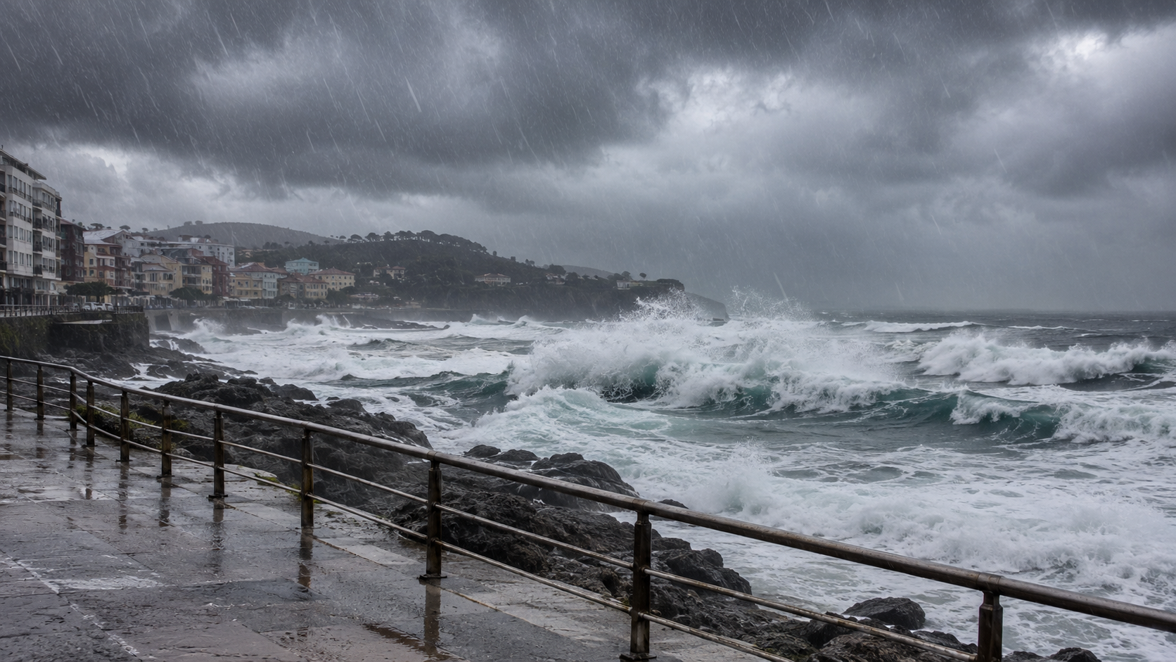
Spain is facing a significant change in weather. Starting this weekend, the storm system “Borrasca Bruna” will bring heavy to very heavy rainfall, thunderstorms, strong wind gusts, and, along the coasts, potentially severe sea conditions. The western part of the Iberian Peninsula – specifically Galicia, Extremadura, and western Andalusia – will be most affected. In some areas, total rainfall could exceed 200 liters per square meter over the course of the event. Authorities are warning of the risk of localized flooding and rising river levels.
Spain Expat Press Editorial Team
by Marlon Gallego Bosbach
Following several relatively calm and mild days, a significant change in the weather is on the horizon for Spain. The cause is “Borrasca Bruna” – a large Atlantic low-pressure system – which is approaching the country and is set to increasingly influence weather conditions starting Saturday. According to the Spanish meteorological agency AEMET, the most challenging weather is expected between Sunday and Tuesday.
For this reason, the Spanish Civil Protection agency (Protección Civil) is maintaining its warnings for the Canary Islands and the Iberian Peninsula. Heavy or very heavy – and in some places, persistent – rainfall is expected, along with thunderstorms, very strong wind gusts, and significantly rougher sea conditions. At the same time, there is a risk of flooding in low-lying areas, as well as the potential for rapidly rising water levels in rivers.
Bruna reaches Spain over the weekend
On Friday, weather conditions across many parts of Spain will initially remain relatively calm. As the day progresses, however, a front will reach Galicia, bringing rain that may, in some places, be accompanied by thunderstorms. Rain is also expected in the western Canary Islands, with the possibility of heavier precipitation, particularly on La Palma.
On Saturday, Bruna will move closer to the Iberian Peninsula. Precipitation will spread from Galicia into Asturias and Castile and León. At the same time, the influence of this low-pressure system on the Canary Islands will increase; there, particularly on the western and mountainous islands, heavy showers and thunderstorms may occur once again.
The current weather pattern does not necessarily bring a cold snap; on the contrary, southerly winds are channeling mild air masses toward Spain. As a result, temperatures could rise significantly over the weekend. In the Cantabrian region, readings may exceed 20 degrees, while in the Guadalquivir Valley, temperatures could climb above 25 degrees. Furthermore, the risk of frost across the mainland is largely subsiding.
The most critical phase begins on Sunday
The situation will become significantly more difficult starting Sunday. At that point, several fronts associated with Bruna will reach large parts of the western Iberian Peninsula.
Areas particularly affected include western Galicia, Extremadura, western Andalusia, the Cantabrian Mountains, and the region surrounding the Sistema Central. The southern part of Castile and León and the northern part of the Madrid region also fall within the zone expected to receive the heaviest precipitation. Rainfall in these areas may be heavy to very heavy and persist for extended periods; thunderstorms are also likely. Furthermore, very strong wind gusts are expected at higher altitudes and in western Galicia.
For many other regions, the deterioration in weather conditions will initially be less drastic. While some precipitation is also possible along the Mediterranean coast and in the Balearic Islands, current projections do not anticipate the same level of duration or intensity as is expected in the west.
More than 200 liters of rain per square meter possible
Meteorologists are monitoring precipitation levels with particular attention. In areas where moist southwesterly winds encounter the terrain, the rainfall can intensify due to the orographic effect – the damming or lifting of air masses by mountain ranges. According to AEMET, more than 200 liters of rain per square meter could accumulate over the course of the entire weather event in the western part of the Sistema Central, as well as in the west and south of Galicia.
This does not represent a uniform amount of rainfall across the regions mentioned. Instead, the greatest risk of precipitation is concentrated in particularly exposed areas. According to the meteorological authority, the precise distribution remains subject to some uncertainty, depending on how the low-pressure system develops.
It is precisely the combination of high precipitation volumes and long duration that makes the situation problematic. This is not just a matter of brief, heavy downpours, but rather of repeated and, in some cases, persistent rainfall spanning several days.
Flood risk increases
With the expected rainfall, the risk of localized flooding and rising river levels also increases. Particularly at risk are low-lying areas, as well as regions where water from higher elevations can flow down rapidly.
An additional concern relates to areas affected by severe forest fires last summer. In these locations, damaged or absent vegetation can reduce the soil’s capacity to retain large volumes of water. AEMET therefore highlights, in particular, the risk in the vicinity of the Sistema Central mountain range in Ávila and Madrid.
The authorities advise the public to monitor the weather situation closely and to follow the instructions provided by the Protección Civil. Those traveling by car should exercise extra caution during heavy rain and must, under no circumstances, attempt to cross flooded roads or areas where water can accumulate rapidly.
It is also becoming dangerous along the coasts
Bruna brings more than just rain and wind; marine conditions are also set to deteriorate significantly. Strong winds are expected in the Canary Islands starting this weekend. From Monday, swells of three to four meters may occur. The mountainous islands will be particularly affected, with the potential for very strong gusts on their peaks.
Sea conditions can become even more intense along the Atlantic coast of Galicia. On the western coast, waves may reach five to six meters starting Sunday afternoon. Western Andalusia should also prepare for rough seas, with waves of around four meters expected there.
The Protección Civil therefore strongly advises against going to the coast during rough sea conditions to watch or photograph exceptionally large waves. Furthermore, vehicles should not be parked in areas prone to flooding or directly along exposed stretches of the coastline.
Temperatures remain unusually mild
Despite the significant change in weather, Bruna does not initially bring a classic cold front to Spain. Southerly and southwesterly winds are transporting relatively mild air masses onto the Iberian Peninsula.
Temperatures are expected to remain well above average in many places on Monday as well. In numerous regions, overnight lows could stay above ten degrees, while daytime highs are set to exceed the 20-degree mark in many areas. In the Guadalquivir Valley, temperatures could even reach over 25 degrees.
For this reason, too, the expected precipitation will fall predominantly as rain. The snow line will initially be very high, meaning that snow will not play a significant role, even in the affected mountainous regions.
Monday and Tuesday will remain particularly wet
Unsettled weather conditions will continue on Monday. The heaviest precipitation will remain concentrated in the west and southwest. In particular, western Galicia, Extremadura, western Andalusia, and the areas around the Sistema Central should expect heavy and persistent rain.
According to current forecasts, the weather situation is expected to change very little on Tuesday. Precipitation may continue to be heavy and accompanied by thunderstorms. At the same time, strong to very strong wind gusts remain possible. Consequently, the most critical phase will span several days. In the view of meteorologists, it is precisely this duration that makes “Bruna” a significant weather event.
Wednesday and Thursday will also remain unsettled
No immediate easing of the situation is expected. According to AEMET, further precipitation is likely on Wednesday and Thursday, particularly in the west and south of Spain.
A gradual weakening is not expected until Thursday. However, the weather authority does not rule out further heavy showers even after that point. The precise development will depend on how the low-pressure system continues to move.
Authorities urge caution
The Protección Civil emphasizes that extra caution is required on the roads during heavy rainfall. Drivers should reduce their speed and avoid stopping in areas where large volumes of water might flow. Parking in areas prone to flooding can also be dangerous; if water levels rise suddenly, vehicles could be damaged or even swept away.
The authorities also recommend checking current traffic conditions and weather warnings before any planned trips, and using main roads and motorways whenever possible.
Spain faces several days with the potential for severe weather
With the arrival of “Bruna,” a significant Atlantic weather system is approaching Spain. This storm – or borrasca – will first strike the Canary Islands and the western part of the country, before moving across the Iberian Peninsula with a series of fronts. Particular attention is focused on the regions of Galicia, Extremadura, western Andalusia, and the Sistema Central mountain range, where exceptionally high rainfall totals could accumulate within just a few days. At the same time, thunderstorms, strong wind gusts, and rough sea conditions will further increase the level of risk.
The situation is particularly critical in areas already weakened by the summer’s forest fires. In these locations, persistent rain can more quickly lead to surface runoff, localized flooding, and rising river levels.
According to the current assessment by AEMET, the severe weather will gradually begin to lose intensity from Thursday onwards. Until then, however, the weather situation will remain tense. Spain is therefore facing several days in which rain, storms, and the risk of flooding – particularly in the west and southwest of the country – will dominate the weather.